Chapter Field Trip on April 13 at 9 am

Wishon Fork out of Springville

This field trip will be a 4.5 mile round trip, with an elevation gain of 1000 ft, moderately strenuous four hour wildflower hike on a dirt road up to the forebay of the Tule River at the Hydroelectric Complex at the junction of Hwy 190 & 208. We expect to see a great wildflower display, and an opportunity to view the regrowth of a recently burned area.

Meet at Springville Community Park in Springville on Hwy 190 at 9:00 am. Bring at least two liters of water and a bag lunch. Chapter field trips are open to everyone.

For more information, contact Cathy Capone 559 361 9164 or cathycaponemail@gmail.com

Upper Tule River, photo from Cathy Capone

Citizen Science Field Workshop—March 23

Saturday March 23, 2019 from 9am-12
Tule River Parkway in Porterville

Enjoy the native vegetation along the Tule River and learn how to use Observer Pro, a smart phone app, which provides a platform in which to upload plant observations to CalFlora. The group will meet in the Jaye Street parking lot just south of the Jaye Street Tule River bridge. Cathy Capone will give a brief presentation on CalFlora, the website where the Observer Pro observation data is stored. She will then take the group on a walk in the riparian forest, while demonstrating and coaching participants to input their observations.

To find the location, enter the parking lot while traveling south on Jaye Street immediately after you pass the bridge railing. Bring water and wear sturdy shoes. Event will be held rain or shine. There are no bathrooms available at the event. The walk will be on a paved path with the option to walk into the natural areas for close observations. The walk is under a mile in length and includes an elevation gain of less than 50 feet.

To make full use of the training, log in to calflora.org and register as a contributor. Then download the Observer Pro app to your phone. There is no charge for the workshop or the app. Cathy Capone is an officer of both the Tule River Parkway Association and the Alta Peak Chapter of the California Native Plant Society.

For more information, contact her at 559 361 9164 or tulerivergarden@gmail.com

Tule River Parkway Walk in Porterville — January 19 from 9-11 am

Alta Peak Chapter Horticulture Chair, Cathy Capone, will lead this walk, designed to highlight the native vegetation along the Tule River and to discuss plans to enhance the area. The walk will be on an easy, flat, paved trail that is wheelchair accessible. The walk is free and open to the public.

The Tule River Parkway Association, in cooperation with the City of Porterville, Partners for Fish and Wildlife, and the Alta Peak Chapter are working to preserve and restore the Tule River riparian corridor in Porterville. The plan is to develop the Tule River Parkway path for public use and to install eighteen native plant landscape gardens. Alta Peak Chapter has pledged to adopt one of these gardens and looks forward to participating in the restoration of the natural riparian landscape.

Wear closed-toed shoes, bring water, and make not that no restrooms are available. Meet at the Tule River Parkway in Porterville on Jaye Street, just south of the bridge over the river. Access is from the south bound lane only- no left turns are allowed at that location, so north bound traffic should make the first available U-turn on Jaye Stree.

Call Cathy Capone at 559-361-9164 or email at tulerivergarden@gmail.com for more information.

Chapter Fall Program: “Explore Calflora’s Native Plant Database”

Friday, October 19, 2018 at 7 pm

“Explore Calflora’s Native Plant Database”
presented by Cynthia Powell, Executive Director Calflora

St. Anthony Retreat, Mission Room 
43816 Sierra Dr (Hwy 198), Three Rivers

Learn about new Calflora tools for Calflora users. Calflora’s plant database hosts over two million plant occurrences, some of which have come directly from Alta Peak members. Powell will go over Calflora’s new plant photo project, planting guide, population monitoring tools, email alerts, and speak more generally about the uses of Calflora for CNPS chapters. She would also like to know how Calflora can better serve the Alta Peak Chapter and to answer any of your questions.

After 3 years as Calflora’s GIS Project Manager, Cynthia is now Calflora’s Executive Director. She graduated with her MS in GIS in 2010 forecasting Mokelumne River water supply based on MODIS remote sensing snow pack images. She’s been examining what was under that snow — plants — ever since. She now coordinates all Calflora programs, research, outreach, and advocacy, as well as fundraising and management.

The Calflora Database is a nonprofit organization dedicated to providing information about California plant biodiversity for use in Education, Research and Conservation.  Calflora is structured as a digital library to fulfill the following objectives:

  1. to serve as a repository for information on California wild plants in electronic formats from diverse sources, including public agencies, academic institutions, private organizations, and individuals;
  2. to provide this information in readily usable electronic formats for scientific, conservation, and educational purposes;
  3. to serve public information needs related to scientific study, land management, environmental analysis, education, and appreciation of California plant life.

Calflora relies on contributors for the information it provides; the website reflects the work of many individuals and institutions.

Field Trip Saturday, October 20, 2018

Join Cynthia Powell for a hands-on plant data collecting field trip for Calflora.
Meet at 8:45 am at Three Rivers Veterans Memorial Building on Hwy 198.
Actual field trip location TBA, in the foothills. Field trip will go to around 2 pm.

from Alta Peak Chapter President, Barbara Brydolf: Did you ever go to a place and look around you, wondering what all those plants are? I certainly have. And I have friends who, mistakenly thinking I’m a plant expert, send me photos of plants to identify. Fortunately, there is a great website and app, called Calflora, for finding out exactly that. Calflora is a nonprofit organization that catalogs California plants by location, genus, common name, and a host of other search terms. I use it more than any other resource to anticipate what I will find in a certain place, and to identify a plant I don’t know. Calflora has catalogued thousands of plant records from all over California, and continues to add information through citizen science, which means that anyone can contribute to the knowledge of what grows here. Our own Mary Merriman, with her Rare Plant Surveys, has made contributions to this site. Calflora is a rich tool, and I know that there are many features that I have not used, not to mention the phone app I haven’t even downloaded yet. That’s why I’m excited that Cynthia Powell, is coming here to Tulare County to give a talk about using the website and app, and to lead a hike the following day. I hope you can join us for this unique opportunity to learn more about native plants!

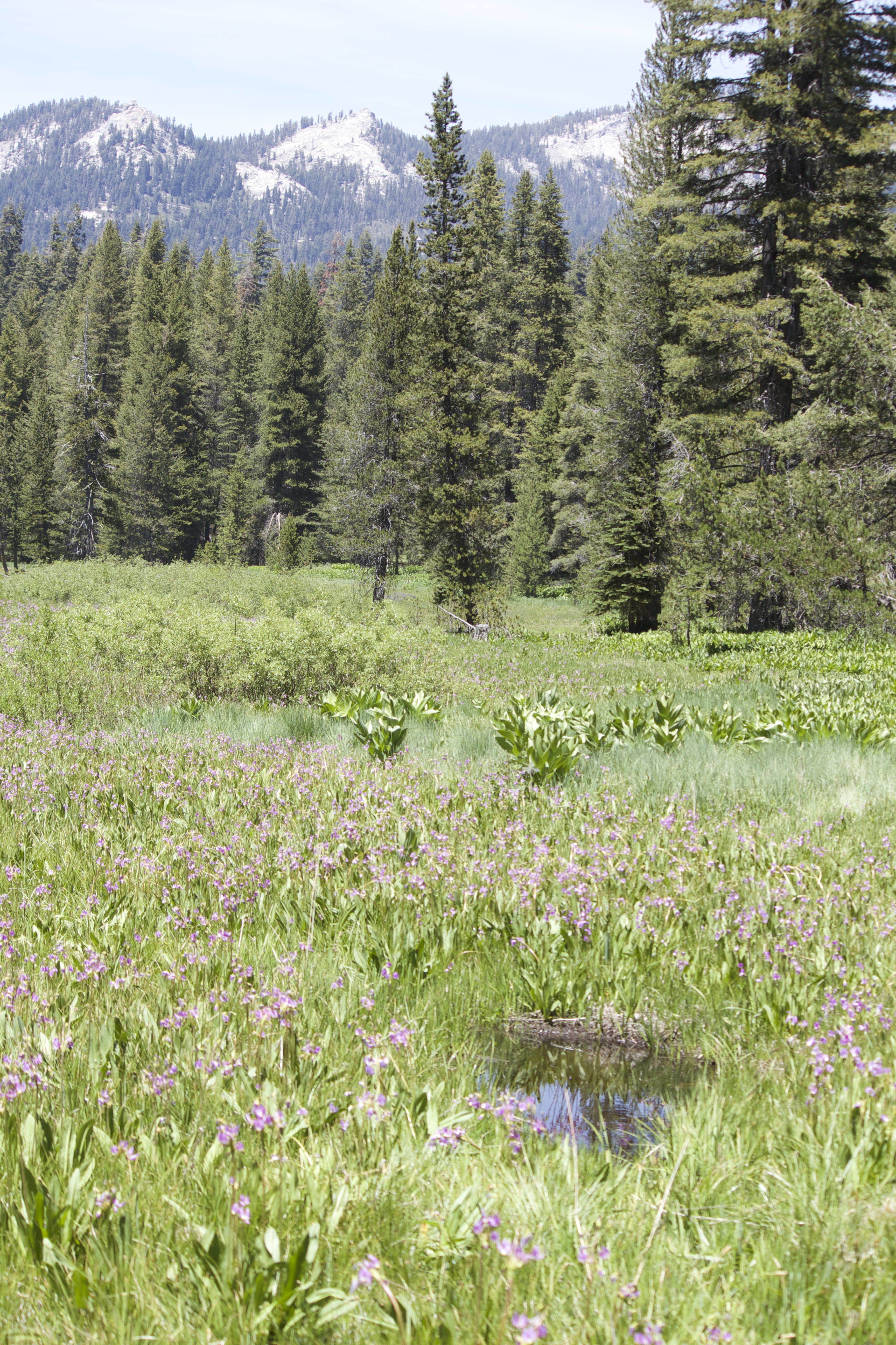
photo: Lewis Hill Preserve near Porterville CA © Sequoia Riverlands Trust

From calflora.org:

What is Calflora?
Calflora is 1. a website you can use to learn about plants that grow wild in California (both native plants and weeds); and 2. a nonprofit organization responsible for providing this service. Calflora is run by the team described below. Information in Calflora comes from many sources: public agencies, non-profits, scientists, private donors, and you!
Find Out About a Plant
You can enter the common or scientific name of a plant to find out about it. Or, use the name wizard to just enter part of a name and have the wizard make suggestions. The result is an illustrated table of plants that match the name you entered. Click one of the plants in the table to learn the details about that plant — in particular, where it’s been observed in California.
Try it out!
Find Out What Plant Observations Have Been Made…
by a certain person, of a certain plant, in a certain area, or during a certain time period. The application that does this is called Observation Hotline. The observations that match your criteria are displayed as colored icons on a Google Map. Click on an observation to see photos and other details.
Try it out!
Find Out What Plants Grow in a Place
You can also choose a place and get an illustrated list of the plants that grow there. The application that does this is called What Grows Here?. You define “here” by picking a place on the map, or by choosing park boundary, place name, etc. Refine “here” by zooming in and out of the map, or drawing a polygon. Then click SEARCH to get an illustrated list of plants known to grow “here.”
Try it out!

There’s a lot more to Calflora than these basic tools — you can learn about Calflora’s more advanced features at the top of this page, where you will find links to many web applications concerning California plants.

Giant Sequoia National Monument Field Trip on July 21

July 21, 2018 from 8 -3 pm

Lead by Barbara Brydolf, Alta Peak Chapter President

Come explore a Giant Sequoia Grove in the Sequoia National Monument above Springville. In the heat of summer, find shelter under the canopy of the giants. We will explore either the Wheel Meadow Grove above Camp Nelson or the Black Mountain Grove near Mountain Aire. We may see mountain misery (Chamaebatia foliolosa), thimbleberry (Rubus parviflorus), Hartweg’s wild ginger (Asarum hartwegii), and could see California tiger lily (Lilium pardalinum), stream orchid (Epipactis gigantea), scarlet bugler (Penstemon centranthifolius), and Scouler’s St. John’s wort (Hypericum scouleri).

Meet at the Springville Veterans Memorial Park, on the right side of Hwy 190 between Gifford’s Market and the Fire Station in downtown Springville. We will carpool and caravan up the highway. Expect as much as a five mile hike over varied terrain and elevations around 4500-5500 feet.

Bring lunch and water. Wear sturdy shoes and be prepared for sun and mosquitoes.

For more information, contact Barbara Brydolf at bbrydolf@gmail.com or 559-359-2827.

photo via Valley Public Radio
fron an episode of Here and Now with Ezra David Romero,

Big Meadow Wildflower Field Trip on June 23


Saturday, June 23, 2018 from 8:30 am – early afternoon
Lead by Mary Merriman, Alta Peak Chapter Rare Plant Chair
and Denise Griego, Alta Peak Chapter Secretary

Explore the high altitude flora of Sequoia National Forest Hume Lake District, located between Giant Forest and Grant Grove. Big Meadow has the highest altitude with accessible roads in Tulare County. Its subalpine flora is dominated by lodgepole pine, white/red fir forest on exfoliated granite. 
It will still be late spring there! We may find a few relatively rare plants, such as Tulare County buckwheat and Sierra bleeding heart and we may find several kinds of monkey flowers although they are more unpredictable in dryish years. Wet meadows hide many floral treasures throughout the season. Shady stream banks harbor a variety of shrubs.

From Three Rivers area, meet at the Veterans Memorial Building on Hwy 198 at 8:30 am for carpooling. Try to bring the fewest number of cars possible. From Visalia area, we will be taking the shorter route up Hwy 180 through the Kings Canyon entrance. If you are coming from Visalia area, contact Mary Merriman at 559-679-9152 or marymtnspirit@gmail.com for directions up Hwy 180 or for ride-sharing, especially if you do not have a park pass. There is now a $35 entrance fee to the National Parks, so be sure to bring your annual or senior pass.

Meet on the Big Meadow road at 10:30 am at the first parking lot (map link here). There is only one way to turn at the Big Meadow Road but it has a fairly small sign. About 1/4 mile up the Big Meadow road, there is a gate (which will be open) and large parking lot on the right with an outhouse where we will start. We will mostly be driving or walking with no significant hiking but plenty of uneven ground so wear sturdy boots. Bring lunch, water, sunscreen, hat, layered clothing (mornings can be cool), field guides and a lawn chair for lunch.


Big Meadow photo by Denise Griego


March 25 Field Trip: Fire Effects in Blue Oak Woodland

Sunday, March 25, 2018 from 9:30 – 12:30 pm at the River Ridge Ranch in Springville

Gary Adest of River Ridge Institute, Alta Peak Chapter President Barbara Brydolf, and forest experts Nina Hemphill and Ernie Garcia will lead this field trip to see how the Pier Fire has changed blue oak (Quercus douglasii) woodland on the lower slopes of Lumreau Mountain. We will explore the effects of the fire on soil, vegetation, and wildlife, and discuss the function of fire in the landscape. Expect to see wildflowers on this walk.

Meet at 9:30 am in the lower parking lot of River Ridge Ranch, located at 37675 Balch Park Rd, on the east side of the road, 1.6 mi. north of the White Barn in Springville. The walk will be moderately strenuous, approximately 5 miles, with a 1000’ elevation gain. Bring lunch and water and dress appropriately.

[photo credit: River Ridge Institute]

Adaptation of Plants, Animals and Humans to Wildfires: What to Expect Following the Pier Fire

Alta Peak Chapter events are free and open to the public.

Saturday, February 24, 2018  at 7pm (social time starts at 6:30)

Chapter Winter Program
“Adaptation of Plants, Animals and Humans to Wildfires:
What to Expect Following the Pier Fire”

with Dr. Jon Keeley, fire ecologist/research scientist for the United States Geological Survey
and adjunct professor UCLA

Springville Veterans’ Memorial Building on Hwy 190

Wildfires are a necessary part of the ecology of many wild landscapes in mediterranean-type climates across the globe, promoting healthy wildlands and biodiversity. After an explosive fire year in California, many questions arise as humans more commonly move into areas that are subject to burning. Dr. Keeley will provide an overview of the fire history of Sierra Nevada forests and shrublands, describing interesting ways plants and animals have adapted to survive wildfires. This talk will touch on important issues related to the wildland-urban interface, as well as the future in an era of global change.

Saturday, February 24, from 1-4 pm
Field Trip: Pier Fire Area

before Winter Program in Springville

Led by Jon Keeley and Barbara Brydolf, this field will be mostly driving along Hwy 190 above Springville with stops at various overlooks, and a short hike on steep terrain (this could be skipped by people who want to go on the excursion, but are unable to do the hike).

Meet at the Springville Veteran’s Memorial Building at 1 pm to caravan and carpool. Carpooling is encouraged, as pull-outs along Hwy 190 are limited.

After the field trip and before the program, join Chapter members for dinner at Nuevo Mexicali III restaurant in Springville, located at: 35258 Hwy 190.

Long Meadow Field Trip in Sequoia National Park

June 25, 2016, at 12 Noon
All Chapter field trips are free and open to everyone.

Long Meadow in Sequoia National Park © Elsah Cort
photo by Elsah Cort

Take a stroll with National Park Service Plant Ecologist, Erik Frenzel around Long Meadow (in the Wolverton area). Long Meadow is at 7,250 ft elevation, two miles north of the General Sherman tree in Giant Forest. This is one of the most gentle and botanically lovely walks in the front country of Sequoia National Park. The trail is flat to moderately sloping for less than two miles, looping around the open Long Meadow, with shaded portions that dip into the surrounding upper mixed conifer forest. Along the way, the group will catalogue the plants that are discovered and learn about the ecology of the meadow.

For directions, it’s best to follow the park map that is given at the Ash Mountain entrance station of Sequoia National  Park. Be prepared to pay $30 entrance fee if you do not have an annual pass. The Wolverton turn off is two miles north of the General Sherman Tree. The drive to Wolverton from then entrance station to Giant Forest in Sequoia National Park takes about 45-60 minutes.

Meet at 12 noon on the deck of the Wolverton snack shop (closed) that overlooks the meadow, where we will gather for lunch (bring your own). The guided walk will begin after lunch, around 12:30 pm.  This is a field trip for all ages and is open to everyone. Bring sack lunch, water, hat and sunscreen.

If possible, please RSVP to Ginger Bradshaw, by email at gingerbradshaw936@gmail.com
or by phone at 559-827-7604.

Field Trip and Rare Plant Treasure Hunt on Lewis Hill Preserve

Saturday, February 27, 2016 from 10 – 1 pm

Co-Sponsored by the Sequoia Riverlands Trust
and the Alta Peak Chapter of the California Native Plant Society

Field Trip Leader: Fletcher Linton, Sequoia National Forest Botanist

Lewis Hill Preserve © Sequoia Riverlands Trust

The open grasslands and blue oak woodlands of the southern Sierra Nevada foothills provide critical habitat for many native plants, along with two exceptional rare wildflowers at Lewis Hill Preserve. In 1994, the Hawkins family donated this property north of Porterville to the Kern River Research Center. Six years later, the title transferred to the Tule Oaks Land Trust, which later merged with Sequoia Riverlands Trust.

Enjoy the rare opportunity to visit this property which is mostly an annual grassland with many varieties of wildflowers that are blooming this time of year including golden stars (Triteleia ixiodes), and Ithuriel’s spear (Triteleia laxa) and two rare plants, the exquisite and fragrant striped adobe lily (Fritillaria striata) and the San Joaquin adobe sunburst (Pseudobahia piersonii). Both of these rare species are very difficult to find anywhere else in Tulare County. On the way up the hill we will put markers down where we find these elusive flowers. Alta Peak Chapter Rare Plant Team leaders, Ann Huber and Mary Merriman, will be on hand to assist in documenting the sighting of these rare plants on the CNPS Rare Plant Treasure Hunt survey forms to be turned into the State Office of CNPS.

The walk is moderate in difficulty due to the rocky ground and steep hill (700 ft), but only about one mile round trip. Bring water, snacks, sun hat and sunscreen as needed. CNPS field trips are free and open to the public.

At the end of the walk Sequoia Riverlands Trust participants can enjoy flying the kites in the breezes found on the top of the hill. Bring your own kite.

Directions: Going South on Highway 65 (towards Porterville), turn left at the Strathmore exit. Travel east several miles and turn right (south) at Avenue 256.  Lewis Hill is near the top of the grade on the right. Park along side of the road.

For more information contact Ann Huber at 559-561-4562.

Wildflowers on Lewis Hill Preserve © Sequoia Riverlands Trust

Lewis Hill Preserve © Sequoia Riverlands Trust

All photographs © Sequoia Riverlands Trust

Field Trip to Intermountain Nursery on October 10

Saturday, October 10, 2015
8 am to late afternoon

, meet at Nursery at 9:30 am

Harvest Festival at Intermountain Nursery
30443 Auberry Road
Prather, California

Meet to carpool at 8 am at Mary’s Vineyard Shopping Mall (near the McDonald’s)
at 1447 E. Noble Ave, Visalia at the Ben Maddox exit off Highway 198

In lieu of the annual Alta Peak Chapter’s native plant sale, which will return October, 2016, a special field trip is slated to visit Intermountain Nursery in Prather, one of the best Central Valley located places to find quality California native plants. A vast selection of well grown native plants, naturally adapted for drought-tolerant landscapes, will be available. The field trip coincides with the annual Harvest Arts and Peace Festival at the Nursery and will include music, art, fine crafts and artisan foods.

Alta Peak Chapter members will be with the group to answer questions about growing native plants. The nursery sales staff will also be on hand to answer questions and will help in selecting the right plant for the right place.

The group will carpool  from Visalia to Prather or participants may choose to meet at the  Nursery at about 9:30 am.  Although the Harvest Festival actually starts at 10 am, the Chapter has been invited by the owners, Ray Laclergue and Bonnie Bladen, to arrive any time after 8:30 am. Please allow room in your vehicle for any plants that may be purchased at the nursery.

This Field Trip is free and open to anyone. A map to the Nursery can be found here.  For information about the field trip, call 559-799-7438.

Intermountain Nursery[nursery grounds, photo via intermountainnursery.com]

Intermountain Nursery[herb garden, photo via intermountainnursery.com]

________________________________________________________
Other Fall Events with Alta Peak Chapter

September 19: Chapter Fall Program
“Creating Drought-Tolerant, Wildlife-Friendly Native Landscapes”

October 3: Native Plant Landscape Design Clinic

Mineral King Field Trip on September 12

Cold Springs Trail view, Mineral King, Sequoia National Park © Denise Griegophoto credit: © Denise Griego

On Saturday, September 12, 2015, join the Alta Peak Chapter for a leisurely hike along the Cold Springs Nature Trail in Mineral King, Sequoia National Park.  The field trip leader will be Interpretive Park Ranger, Josh Schultz. Participants will explore this beautiful Alpine Valley and learn about the unique challenges it presents to the plants that call it home. The aspen trees will be changing color and the group will be able to enjoy a touch of autumn in the air.

Cold Springs Nature Trail is two miles long with no significant elevation change at around 7,800 ft. It is a dirt surface with a few rocky areas. The walk will be about one and one half hours. Meet at the Cold Springs Bridge at 12:30 pm and the field trip will begin at 1 pm.

California Native Plant Society field trips are free and open to anyone. Bring lunch or a snack, water, a jacket as it may be chilly, a magnifying loop and favorite plant guide.

Directions to Cold Springs Trail: Follow highway 198 east towards the Sequoia Park entrance.  About two miles before you enter the main park, you will see a sign on your right for Mineral King Road. It will indicate 26 miles to Mineral King.The road is very narrow, winding and poorly paved in places. A few sections are still dirt. It will take about an hour and one half to reach Cold Springs from the turn off at the junction of 198.

To join a carpool, meet at the Three Rivers Veterans’ Memorial Building lower parking lot at 10:30 am. The Memorial Building is on Highway 198 at the eastern end of Three Rivers. Drive east, past the Three Rivers Elementary School on the right, past the Baptist Church, also on the right and continue east on Highway 198 for a few minutes. Drive past Reimer’s Candy, a big red shop on the left and past the closed We Three Bakery on the right. Just past the Community Presbyterian Church sign and driveway, on the right, look for a “buckwheat hedge” with rust colored flowers and behind that, a large parking lot as well as a marquee announcing the Veterans’ Memorial Building, which is also host to one of several community California Native Plant gardens.

For more information, contact Shelley Quaid, Alta Peak Field Trip Chair, at 559-623-4233.

View from Cold Springs Trail in MIneral King in Sequoia National © Denise Griegophoto credit: © Denise Griego

Field Trip: High Meadow in Giant Forest

On June 14, 2014, at 12 noon, take a stroll with National Park Service botanist, Erik Frenzel, and  plant ecologist, Ann Huber, along Long Meadow (in the Wolverton area). This is one of the most gentle and botanically lovely walks in the front country of Sequoia National Park. The trail is flat to moderately sloping for less than two miles, looping around the open Long Meadow, with shaded portions that dip into the surrounding upper mixed conifer forest. Along the way, the group will catalogue the plants that are discovered and begin a plant list for Long Meadow. After the walk, those who want to continue the botanical adventure will visit Dorst Campground to monitor the rare sunflower Hulsea brevifolia (Short-leaved Hulsea).

The meeting spot will be on the deck of the Wolverton snack shop (now closed) that overlooks the meadow. Gather here for lunch (bring your own) at 12 noon. The guilded walk will begin after lunch, around 12:30 pm. This is a field trip for all ages and is open to everyone.  Long Meadow is at 7,250 ft elevation, two miles north of the General Sherman tree in Giant Forest.

Those people who are interested in carpooling can meet at 10:45 am at the Three Rivers Memorial Building on Highway 198 in Three Rivers. If you decide to drive to Wolverton on your own, follow the signs on the Generals Highway in Sequoia National Park.  The Wolverton turn off is two miles north of the General Sherman Tree. The drive to Wolverton from the Ash Mountain entrance station to Giant Forest in Sequoia National Park takes about 45-60 minutes (maybe longer if there is road construction). For directions, it’s best to follow the park map that is given at the entrance station of the park. Be prepared to pay the $20 entrance fee to the park if you do not have an annual pass.

Bring sack lunch, water, hat and sunscreen as needed.

A special group campsite has been reserved for Saturday night, if you are interested. Please RSVP by June 7 to Ann Huber at ahuberdas@gmail.com or call 559-561-4562

High Meadow in Giant Forest, © Elsah Cort[photo © Elsah Cort]

Summer Field Trips

For all Alta Peak Chapter  field trips, hikes, and walks, bring your own water, whatever food you want, sun hat, and sun screen.  The elevation for these summer field trip sites is around 7-9000  feet.

For more information call field trip leader, Joan Stewart, at 539-2717.

June 11: Jordan Peak
If, and this is big question, the North Road is open, and snow is mostly off ground, this would be  time to see the Erythronium in bloom, in addition to 40-50 other plants along the trail. People come from far and wide to see this lily, one of several in genus, each found only on its own mountain top, along the Sierra crest. The climb from trailhead is just over 2 miles. The peak is about 9100 feet elevation. As in former years, we meet at 10 am at the junction of North Road and the end of Highway 190, just beyond Quaking Meadow turnout.

July 9: Meadows along North Road
Some of Joan’s favorite plant/flower wanderings are in and around meadows that lie along North Road.  Each different, each special for one or another reason.  We’ll again meet at 10 am and carpool from the junction mentioned for Jordan Peak, about 24 miles from Springville.

August 6: Nobe Young Meadow
Nobe Young Meadow is historically significant as a site used by early horseback Forest Service high country rangers. It is found off Western Divide Highway about eight miles beyond the North Road junction, about 1.4 miles up Crawford Road, west of the Western Divide Highway.  Joan has spectacular color photos of this meadow from previous visits.


photo by Cathy Capone

Alta Peak Chapter Field Trips for Spring 2011

Read the details and dates for the Chapter’s field trips planned, so far, on this field trip calendar.

Call Joan Stewart, at 539-2717, to confirm details 
about each field trip, like where to meet at 10 am.

Summer Field Trips at higher elevations will be planned for June and July, and will be featured in our next newsletter coming out in late May. An up-to-date field trip schedule will be posted on the this website as field trips are scheduled.